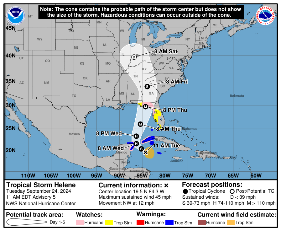
TAMPA, F.L. (NCC NEWS) — A hurricane watch has been issued for Florida’s gulf coast ahead of Tropical Storm Helene. The storm is expected to intensify into at least a Category 3 Hurricane by Thursday when it is scheduled to make landfall in the U.S.
During its landfall Helene has the potential to bring winds up to 73 mph, storm surges 5 to 8 feet above ground, and flooding greater than 6 feet above ground.
Tropical Storm Helene will continue to affect the Cayman Islands and move closer to Cancun, Cozumel, and western Cuba on Tuesday.

Upcoming Forecasts
Helene is forecast to be closest to Cancun and Cozumel on Wednesday bringing heavy rain and floods to the areas. Western Cuba will also be hit with heavy rain and strong winds before the storm is expected to turn into a hurricane as it enters the Gulf of Mexico.
By Thursday, the storm is expected to intensify rapidly in the eastern Gulf and make landfall on Florida’s Gulf Coast late Thursday afternoon or Thursday night.

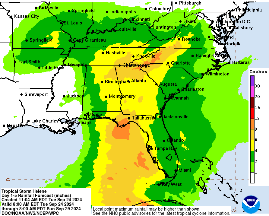
After its landfall, Helene should lessen in intensity and head north through the Southeast with lingering strong winds and rain.
