SYRACUSE, N.Y. (NCC News) — It’s been a harsh winter in Central New York, with temperatures well below average and a snowfall total not seen in years.
It seems like it’s finally starting to back off with temperatures rising back above freezing for the first time in months. But just what goes into forecasting and tracking all of this data?
For Syracuse, a good place to start is the National Weather Service branch in Binghamton. They run the models and collect data from contracted observers around the state on an hourly basis, as well as run their own tests.
“Up in Syracuse, this has actually been one of the snowier winters in recent years,” said Ben Lott, a forecaster at NWS Binghamton.
So far, as of Feb. 19, Syracuse has received 127.7 inches of snow this season, making it the current snowiest city in America. That’s well above the five-year average, but perhaps somewhat concerningly for those tracking global warming, it’s only tied with the 30-year average.
That data doesn’t come directly from Binghamton, they have computer models, and their own local measurements. But to get accurate data, the NWS turns to more direct methods.
“Some of the airports including Syracuse have contracted human observers, who are also submitting observations as well,” Lott said.
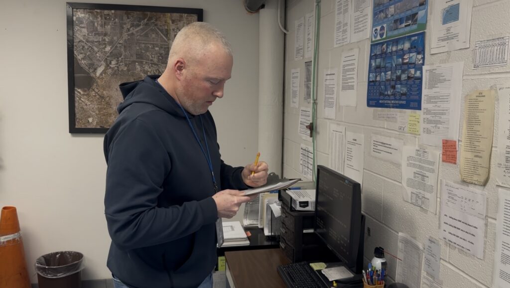
If one wants a truly accurate picture of where their weather data comes from for the forecast on your phone, the local news, and even the National Weather Service, look no further than the men and women like Scott Manning.
Manning is the senior weather observer for Syracuse Hancock International Airport, one of many working in airport weather observation offices around the state.
“Our job is to augment, you know, make sure the information that the equipment says is correct.” Manning said.
That means donning a coat, hat and gloves, every hour on the hour and checking the snow with a yard stick and writing down the totals on the clipboard. Manning needs to be as analogue as possible, one slip up could be the difference between a clear runway and a downed plane.
Especially on days when the forecast calls for a mix of precipitations. The difference in a few degrees is the difference between snow, freezing rain and rain and that’s the difference between an on-time flight or a delay.
“The equipment we have, it doesn’t do well trying to distinguish between the different types of precip(itation), especially when the temperature is right around freezing,” said Manning.
It’s like trying to hit a knuckleball, the forecast is constantly in flux on certain days and it is imperative that Manning get it right.
The weather observation office is also in charge of record keeping and has the weather data for every day of the last nine years ready at hand, and decades more data in storage.
Even though Syracuse has only hit its 30-year average, Manning warns that there could be much more to come.
“We’ve got another six weeks of snowfall potential, we could be 140, 150 (inches)” said Manning.
Whether it’s nothing, or another major storm coming, Manning will be at the weather office to track every inch.